
Met Éireann has extended a status orange warning for dangerous storm force winds tomorrow to all parts of the country.
Winds of up to 80km/h from Storm Brendan will reach the west and southwest from 5am, with strong winds in all areas by 8am.
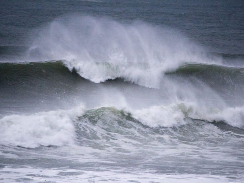
The National Directorate for Fire and Emergency Management says all coastal areas could experience coastal flooding, especially tomorrow.
It says local authorities have activated their local co-ordination and crisis management arrangements to prepare for its arrival.
They are advising coastal communities that there is a significant risk of coastal flooding from early morning tomorrow.
Met Éireann's head of Forecasting Evelyn Cusack (pictured) says the storm system is developing rapidly in the North Atlantic this evening.
"Storm Brendan is moving off Canada at the moment. There's a very strong jet stream [defined by weatheroutlook.com as a 'narrow band of predominantly westerly winds'] across the Atlantic, and as it engages with that, it's deepening," she said.
"A weather bomb* as you call it, deepens at a rate of about 24 hectoPascales in 24 hours and Storm Brendan is deepening at about 50 hectoPascales in 24 hours." (One millibar is equivalent to 100 pascals or one hectoPascal - meteireann.ie.)

* A 'weather bomb' is an unofficial term for a low pressure system whose central pressure falls 24 millibars in 24 hours in a process known as explosive cyclogenesis - UK Met Office.
EARLIER: Coast Guard warns of storm surges on the coast as Storm Brendan approaches
People in coastal counties are being warned of high tides and storm surges as Storm Brendan makes its way towards Ireland.

File photo. Pic: Photocall
Its first effects are expected late tonight, with three wind warnings kicking in tomorrow from 7am.
Two are orange alerts, and cover all counties along the south and west coast, while a yellow warning covers the rest of the country.
Dublin City Council will erect flood defences and close the car parks at Clontarf and Sandymount from 6am on Monday, until Monday afternoon. The council said it may also be necessary to close some flood gates along the River Dodder in Ballsbridge. Dublin City Council will continue to monitor the weather over the next few days.
The Orange wind warning for Donegal, Galway, Leitrim, Mayo and Sligo will be in place to midnight, while the warning for Wexford, Clare, Cork, Kerry, Limerick and Waterford lifts at 3pm.
The forecaster is predicting gusts of up to 130 kilometres per hour.
Harm Luijkx from Met Eireann said it will be very windy in some parts all day.
Mr Luijkx said: "For the north-west it will be out from seven o'clock in the morning on Monday until midnight. For the south of the country the worst will all be over by midday, but that will also start from seven o'clock on Monday morning."
Meanwhile, the Coast Guard is advising people to avoid exposed beaches, cliffs and harbours during the storm conditions.
Any power outages can be reported to ESB Networks on 1850-372-999, with the public being reminded to never approach or touch fallen electricity wires.
The National Parks and Wildlife Service (NPWS) is to close six of its facilities tomorrow due to the warnings.
- They are:
- Killarney House and Gardens, Co. Kerry
- Dromore Woods Nature Reserve, Co. Clare
- Coole Park & Gardens Nature Reserve, Gort, Co. Galway
- Connemara National Park, Co. Galway
- Knockma Woods Reserve, Tuam, Co. Galway
- Wild Nephin/Ballycroy National Park (closed since October and will remain so until late March)