

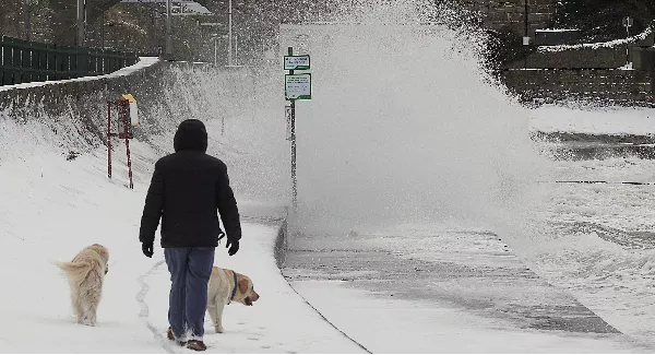
Update 10.45am: A nationwide status yellow snow-ice warning has been issued for the rest of this week.
Met Éireann says it will be very cold this week with scattered wintery showers - the worst of which could fall on Thursday.
The warning will be in place from tomorrow at 6am until Saturday, February 2 at 6pm.
The forecaster says this week will be very cold "with scattered wintry showers, frequent across the southwest, west and north. Some accumulations of snow are expected.
"There will be widespread frost at night with icy stretches on untreated surfaces.
"There is the possibility of a more significant spell of sleet/snow on Thursday."
'It looks like we're in for one of the coldest weeks of the winter season so far'
Temperatures could dip as low as -5 degrees this week.
People are being warned of wintry showers with accumulations of snow on high ground.
Met Éireann says that this week will be very cold and that frost and icy patches will be frequent at night.
Meteorologist with the forecaster, Matthew Martin, says the cold weather is expected to last until at least Friday.
"So it looks like we're in for one of the coldest weeks of the winter season so far," said Mr Martin.
"Some quite cold air is going to funnel in across Ireland from Tuesday onwards and we're expecting some wintery showers and widespread frost at night."
Tuesday and Wednesday will have clear spells, according to Met Éireann, but there will be scattered wintry showers with sleet or snow in northern areas and on hills and mountains.
Thursday will start dry but "rain, sleet and snow will gradually spread from the southwest."
Friday will see more cold weather with sunshine in between further wintry showers.